

Great Falls Park, covering an area of 800 acres is a small scheme National Park along the bank of Potomac River in Northern Fairfax county of Virginia.


It is a disconnected but integral part of The George Washington memorial Parkway.


Great Falls are near northern boundary of the Park and are the remains of Patowmack Canal which was the first canal in USA that used locks to raise for lower boats. Due to the high and low levels of water at Potomac River, The Patowmack Canal was finally not successful.


This destination of recreation located in the census-designated place in Fairfax County is only 15 minutes drive away from the nation's capital, DC Washington.


Great Falls Park is a great attraction to neighborhood. The park is accommodated with large picnic area and 600 parking lots which always are fully filled up with vehicles early morning during weekends. An entrance fee of US$5.00 is chargeable per car to drive into the park.


Swimming and Wading are prohibited in the park because of its dangerous river currents and hydraulics.


Entry into water above the falls from Virginia is also illegal as there is an average of 7 drownings per year occurred in Potomac River in the park vicinity.


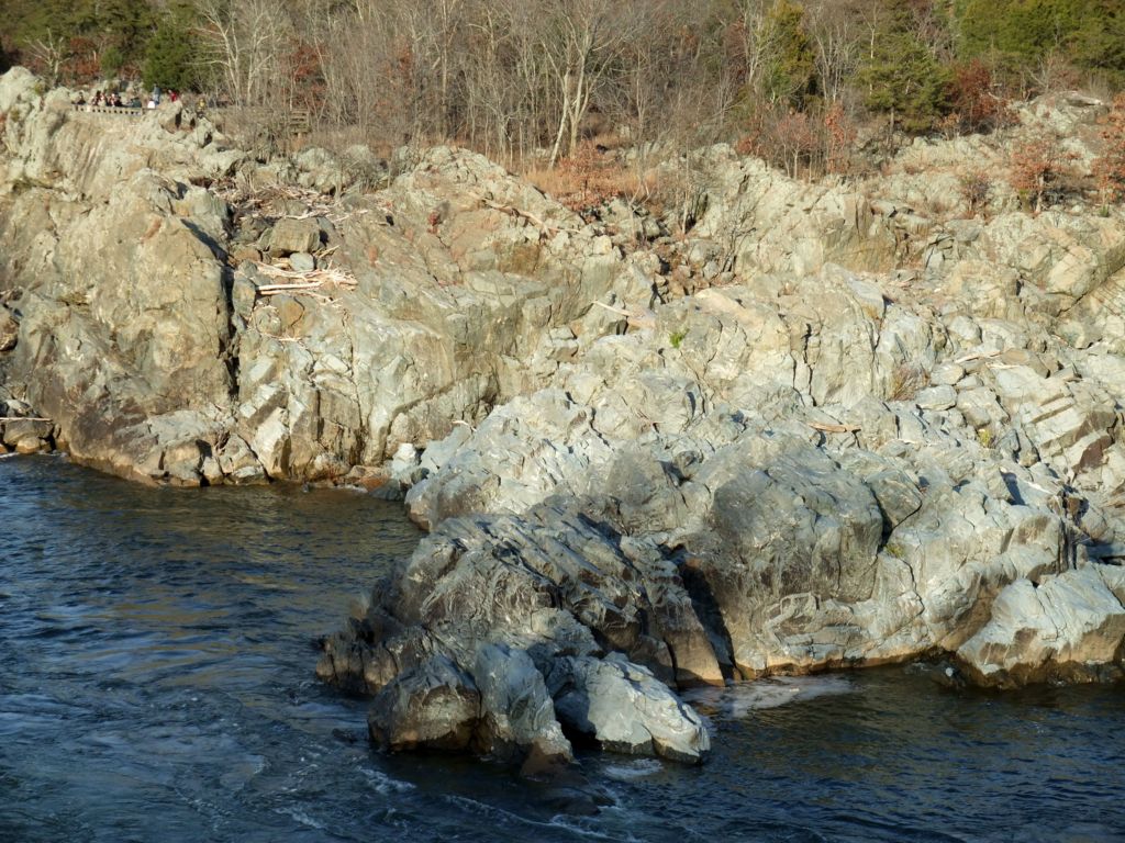
Potomac River builds up speed and force as it falls over a series of steep, jagged rocks and flow through the narrow Mather Gorge.


The powerful force of Potomac River.


It is a site with a comparable diversity of landforms , plants and natural communities.


Bedrock terraces high above the river, precarious ledges and flood plains have become a fragile home to over 30 distinct plant communities in which 3 are not found in any part of the world.


The unusual landscape with wild river and rocky terrain has made The Great Falls one of the most biologically diverse areas in USA.


Millions of people see the river as a place to recreate or to escape from busy lives.


In earlier time, people depended on the river for food and made their houses along the river banks while the European settlers sew the river as a source for transportation, expansion and settlement.


Most of the people in DC area actually depends on Potomac River as a source of drinking water.


There are 14 trail-side exhibits within its 2 1/2 miles long trails illustrating the unique features of The Potomac River and the important role it fills within the watershed.


Potomac River provides a globally rare environment for the diverse rare life to continuously exist.


Through millennium, the true sculptor of these gnarled rock faces is the erosional forces of the powerful Potomac River, and today still continues to be.


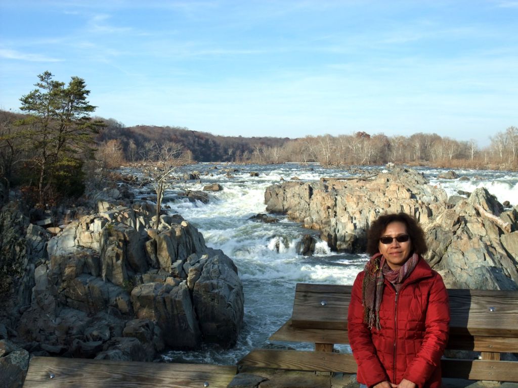


There are several viewing platforms providing vantage points to overlooking the falls.


The rocky cliffs tops are homes to an astonishing variety of trees and plants.


The powerful flood in Potomac River scour the landscape, transporting plant seeds to new home on the cliffs.


People come here to enjoy this scenic spot but unaware of the devastating flood potential.


The Patowmack Canal (1785-1828) offers a glimpse into the early history of the county. It was the most demanding and complex of the 5 canals built by Patowmack Company whose founder, George Washington, made the canal to improve Potomac River for access trade with western frontier .


Walking through the scenic trails along with Potomac River to explore the history and nature in this beautiful park.


The home of these hawks?


The building of visitor center, the scale indicating water level of the flood, and a boater with his kayak on head.


Mather Gorge is a gorge within a gorge. This miles long narrows bounded by steep rocky cliffs and cover sparsely with vegetation lies within the 15 miles long Potomac River Gorge.


Mather Gorge.


Since 1990's, Great Falls has become a popular destination for expert white water boaters in DC area.


And the falls through Mather Gorge has been a very popular kayaking run since 1960's.


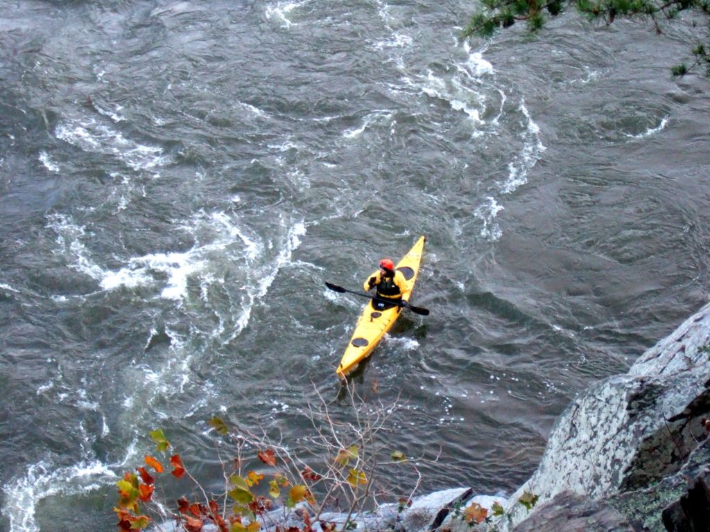
Sitting on the cliffs watching the boaters kayaking in the strong current of Potomac River.


There is a 24km hiking trails encompass the park from a small stream known as Difficult Run.


Rock climbers frequent the cliffs in Mather Gorge above Potomac River.


A clear day in late autumn.


While exploring along the trails, you will encounter with numerous potholes on the rocks. They were formed during icing age flood when strong currents moved tons of sediment down the river, rocks obstacles in the river created tornado-like circular flowing and the power of these circular flows picked up fine sediment and drilled into the rock. It takes about 500 years to from a pothole .


Flood occurs when major water events happen in the watershed upstream. Severe snow, storms or snow melt with heavy rain at upstream will cause the river to rise swiftly and the converging water constricted by this narrow funnel, force to rapidly back up and fill the gorge and finally overflow the cliffs .


A hills of red.


From here, The Great Falls of Potomac River winds its way passed through rugged cliffs on its journey to Chesapeake Bay .


Potomac River is the second largest watershed feeding The Chesapeake Bay where DC Washington, the capital of national locates.


