
The Port City, Mobile was also nicknamed as City of Six Flags and Azalea City. It is located at the junction of Mobile River and Mobile Bay on the northern Gulf of Mexico. Mobile, being the 3rd most populous city and the alley seaport in the State of Alabama, is the largest municipality on the Gulf coast between New Orleans of Louisiana and St Petersburg of Florida. The city gained it's name from the native American Mobilian Tribe that French Colonists found in the area of Mobile Bay. During the first 100 years, it was a colony for France followed by Britain and lastly Spain. Mobil began as the first capital of colonial French Louisiana in 1702 and became part of USA in 1810.
The City of Mobile is well situated for trade as its location tied it to a river system that serve as the principal navigational access for most of Alabama and large part of Mississippi. When Alabama was granted statehood in 1819, the frontage areas of Mobile were settled by farmers and plantation economy established, followed by settlements of merchants, attorneys, mechanics, doctors and other seeking to capitalize on trade with this upriver areas. The city further turned into a city of commerce after 1830's with a primary focus on cotton trading and water front developed with wharves, terminal facilities and fire proof brick warehouses. After deepen the shipping channels in harbor during 20th century, ship buildings and steel production became most important to Mobile's economic health. Paper and chemical industries began to flourish after World War II and many military bases were converted to civilian uses. Between 1960's to 1970's after the closing of Brookley Air Force Base and other sectors, the city suffered long period of depression. Economy of Mobile after experienced the economic decline for several decade starts to rebound in 1980's . Now the city is industrialized with aerospace, steel ship building, medicine and many others.


Mobile played a key role in the economic health of the city beginning as a key trading center between French colonists and natives down to its current role as 9th largest port in USA.


The City of Mobile was found by French Canadian brothers Le Moyne to establish control over France's Louisiana claims.


The historic district cover the streets of Dauphin, St Joseph Saint Francis and North Conception.


Mobile City has a population of about 413,000 people almost equally sharing between the white people and African Americans.


Residences and commercial buildings.


Mobile distinguished from all other cities of Alabama. It is a home to an array of cultural influences with its mixed French, Spanish, Creole, and Catholic heritage in addition to British and African. The Annual Carnival celebration perhaps is able to give the best illustration of this.


Oyster and shrimp are the main sea food produce at Mobile Bay and all restaurants in Mobile have oysters served fresh at table for their customers. Oyster House restaurant located at downtown decorated all space of the walls with educational verses and rhyme. Restaurant offers good food with good services that you can hardly find a seat in the evening for dinner.


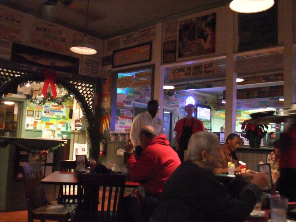
The local delicacies offered from Oyster House Restaurant and they tasted real good especially the cranberry tart desert.


Spanish Plaza is a park at downtown that honors the Spanish Occupation of the city between 1780-1813.


The Cathedral Basilica of the Immaculate Conception, sect of the Archdioese of Mobile and The fountain in Spanish Plaza park, presented to Mobile by the City of Malaga of Spain was to feature the arches of friendship.


Cathedral Square is a performing arts part in the historic district overlooked by Cathedral Basilica of the Immaculate Conception. The Statue of Queen Isabel La Catolica (1451-1504) was the gift from The Spanish Cultural Institute. Queen Isabel La of Castile and husband Ferdinand II of Aragon brought stablity to both kingdoms that became the basis for the unification of Spain. Queen financing Christopher Columbus 1492 Voyage that led to the opening of "New World"


The 12 ceramic benches at Cathedral Square were works of Madrid and Toledo ceramists. They were gifts from 12 cities of Spain and each depict at the bench was the famous vista from that individual city.


Michael Portier was the first Bishop in Mobile and he made this house his home for 25 years (1834-1859) and the four subsequent bishops of Mobile continued to reside here until 1906.


There are more than 45 parks and many museums at the city with some that are of special interest. We came in the odd season that hardly can see a customer going forward to offer this lady a business.


Battle of Mobil Bay was one of the most famous naval engagement of war, resulting the Union taking possession of Mobile in August 1864 . Mobile was a Confederate City during America Civil War and the first submarine to successfully sunk the enemy's ship, HL Hunley, was built in Mobile.


Bienville Square at Historial Park dating to 1850 in the lower Dauphin Street Historical District and is named for Mobile's founder Le Moyne, Sieur de Bienville. The historic city park in the center of downtown Mobile occupies the entire block bordered by the streets in the historic district. . It was a principal gathering place for citizens of the city from 1850's to 1940's and it remains popular today.


Modern buildings of The conventional center and Science center and the statue of Raphael Semmes (1809-1877). Simmes was the captain of the famous commerce raider CSS Alabama during America Civil War. He was an officer in United States Navy and Confederate States Navy at the same time, the only that gained the two titles. He spent his second part of life in Mobile to practice law after the war was over.


The Site of Historic Fort Conde is a reconstruction of original Fort built on the old Fort's footprint. It is the city's official welcome center as well as a living history museum.


Fort Conde was originally built in 1723 in honor of Louis Henri and Prince of Conde.


Fort Conde is a brick fort with stone foundation.


The name of Fort Conde was changed to Fort Charlotte after Treaty of Paris was signed in 1763 and France ceded the City of Mobile and surrounding areas to Great Britain. It was renamed as Fortaleza Carlotta, when Spanish captured the city in1780.


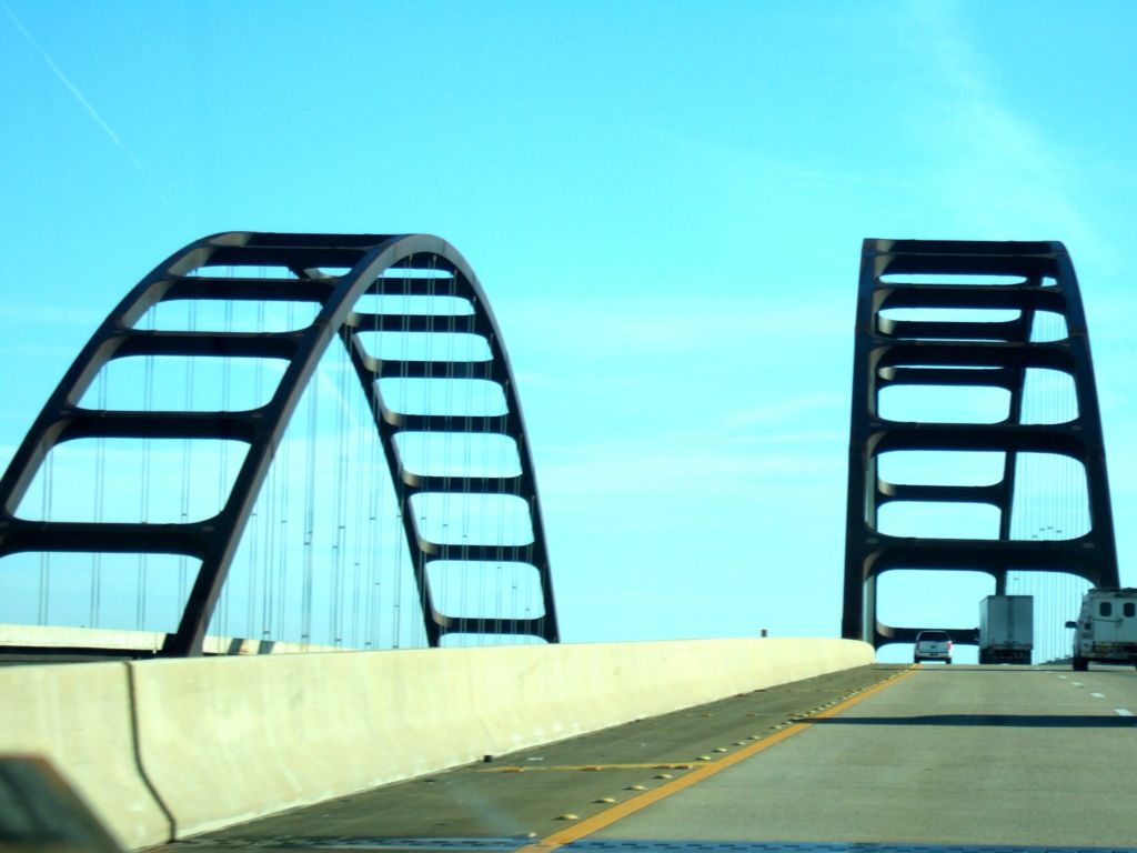
The Gordon Persons Bridge was a 3-miles long high rise bridge, connecting The City of Mobile to Dauphin Island.

The Bridge was opened in July 1982 to replace the original draw bridge that was destroyed by Hurricane in 1979.


It is most convenient and scenic way to cross over to the west shore of the island by The bridge.


Automobile ferry that arrives at east shore of the island is an alternative source of transportation from the mainland.


Dauphin Island is a barrier island at the Gulf of Mexico, 3 miles away south of Mobile Bay. It was originally named as Massacre Island but renamed to Dauphin for Louis XIV's great grandson and heir, Dauphin.


The first documented European to land on the Island was The Spanish Explorer, Alonzo Pineda, who came in 1519 and his long stay on the Island made him able to draw out a map of the Island accurately.


The official history of Dauphin Island dated back as far as 1699 when one of the French Louisiana founders, Pierre Le Moyne , arrived mobile Bay and anchored near the Island on his way to explore the mouth of Mississippi river. He named the Island Massacre Island as large pile of human skeletons were discovered which actually was only a simple burial mound broken open by hurricane.


The French colonists decided to locate a pot on the Island due to its deep water harbor, reliable supply of fresh water and also its abundant timber. The settlements started with a fort, a chapel, warehouses and some residences.


The Island served as a major trading depot unloading goods from Haiti, Mexico, Cuba, France etc and connected by smaller feeder boats to Mobile Bay which was then too shallow for ocean vessels.


Typical elevated houses on the Island.


An estimation of about 1300 permanent residents call Dauphin Island as "Home" and reside in the town of the Island.


Dauphin Island is a wonderful laid-back resort destination. Members of residents soars during vacation and holiday time.


Dauphin Island is 14 miles long by 1 3/4 miles in width. The 6 miles towards eastern side are inhabited while the western 8 miles are almost undeveloped and mostly privately owned.


Dauphin Island is the home to Fort Gains, Sea Lab, Estuarium, Public Aquarium, boat ramps, large public pier, historical sites and beautiful private homes.


The Island lies at the north region of Gulf of Mexico and south of Mississippi Sound and Mobile Bay. Its eastern end helps to define the mouth of Mobile Bay.


Opposite side of the beach is The Mexico Gulf where many oil refineries located.


Beaches attract tourism and fishing is a popular activity in the water around the Island.


Mammals are often seen in the Gulf of Mexico and Mobile Bay waters surrounding the Island.


Dauphin Island at dusk.


Dauphin Island is the first landfall encounter by many birds as they migrate north from South America.


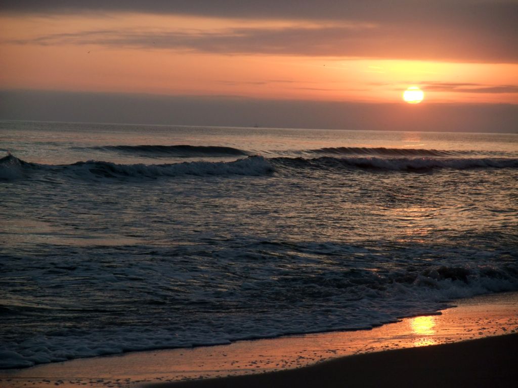
Gorgeous skyline of Dauphin Island in evening light.


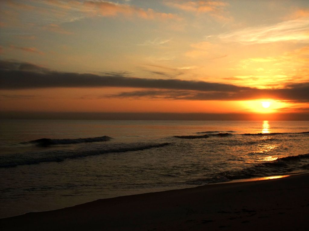
The Stunning sun set at Dauphin Island.


Fort Gaines at the eastern tip of Dauphin Island, was built between 1821-1848. It was occupied by Confederate Forces in 1861 and captured by Federal Troops during Battle of Mobil Bay.


Fort Gaines at night.


Shrimping Vessels are livelihood of many island residents.


The crude oil refinery at Mexico Gulf.


The sugar white sand and the long public pier of the Island.


There are many long and wooden fishing piers along the coast of Dauphin Island.


Wild grasses are the protector of these natural beaches. They were grown at edges to sustain the sand being shifting away from the beach.


At this odd time of year end season, there was hardly a visitor at the beach. It was a good time for the beaches to temporary return to the earth before next exciting moments started again in summer next year.


Pelicans are birds mostly seen surrounding the entire Gulf Coast. Dauphin Island was designated as a bird sanctuary and thousands of visitors come to experience the annual migrations. Audubon Bird Sanctuary occupied 164 acres of land is one of the largest in the Island.


Felix's Fish Camp, a native restaurant along the coast, offers fresh catch from the sea and simple cooking to maintain the original taste of sea produce to their guests.


Fish dishes are their specialties and the seafood chowder tasted great.


The USS Alabama at Battleship Memorial Park on the shore of Mobile Bay.


The head of Mobil Bay is crossed by two major bridges and one of them is known as Jubilee Parkway and also as Byway.


The Bridge Tunnel


Mobil Bay Causeway is another one of the two primary connections between City of Mobile and eastern shores. It is situated at the confluence of 5 rivers Mobile-Tensaw Delta and the expensive Mobile Bay. The 8 miles roadway unprecedented in its natural exposure is an area in harmony with history and culture. From the vintage point, it is also a watery working landscape straddling the line between freshwater rivers to the north and salty waters of the Gulf Coast to the south.


Another name for Mobile Bay Causeway is Battleship Parkway. It is an apex of ecological, cultural and recreation activities and has diversity of scenic charm and recreational opportunities special to this region.


Brick Pit Restaurant located 10 miles away from Mobile Bay, appears like a down home part with gravel parking lot but it was featured into 3 publications as one of the best BBQ joints in the country. The ribs are cooked in blackened and bank-vault sized smoker, under low and slow heat from Pecan wood with mild and sweet flavor.


Its owner Bill Armbrecht, a native of Mobile said that a barbecue restaurant should have homey feel with its own character. The white wall of his restaurant covered with signatures, scrawls, gushy regards and all kinds of writings and drawings.


The interstate free way of Albama.


The bald trees along the shoulders of highway in Alabama.


The assembly plants of Hyundai and Kia Motors are the main automobile industries in Alabama. Roads and sites nearby are named after the company.


Leaving Albama behind with its beautiful skyline.

We stopped here to top up gas and at the same time, admire the stunning sunset in Alabama.


A crimson sunset !


Its awesome!


We had a good time. Alabama, goodbye .............


Entering into the State of North Carolina towards Charlotte Town.


We enjoyed a great traditional southern cooking lunch at Mckoy Smokehouse in Charlotte .


The young boss of Mckoys Smokehouse is the 3rd generation of the family owned restaurant. His grand father passed down the business and the tradition cooking method to his father and then him. They followed and improved the restaurant to even a better dining place for all its customers.


The authentic southern dishes offered by Mckoy Smokehouse. In view of our first visit to the restaurant, we were pampered with small dishes of sample to taste before we made our order. Besides the good food, the hospitality and courtesy of the owner must also give great influences to its good business .


By noon, Mckoy was already packed with guests and many were waiting at the entrance. They friendly exchanged conversations while waiting to be seated. It is understood majority of them are regular customers to the restaurant.


Turquoise blue lake in North Carolina.


A serene living condition in rural area of Charlotte.


Christmas was just around the corner!


Quite a scenic highway driving from North Carolina northwards to Virginia.


Blue Ridges Mountain of Virginia


May I use a few of your photos about Mobile, in a gratuitous, non-commercial 2-minute diaporama I’m developing about Fort Condé, Mobile, Alabama, for educational purposes regarding “French Facts” in America.
ReplyDelete